Magnetic Compass
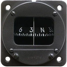
The magnetic compass is the most basic instrument used in aircraft navigation. Even when it is relegated to a background role by more sophisticated mechanical and electronic devices such as directional gyros, VORs, and GPS units, its simplicity and reliability make it a critical (and required) component of aircraft instrument panels. However, it is subject to certain errors which must be understood in order to use it properly. These errors include the following:
Oscillation—erratic movement during turbulence or poor piloting
Deviation—caused by local magnetic fields within the aircraft
Variation—caused by the difference in the physical locations of the magnetic north pole and the geographic north pole
Magnetic Dip— the north-seeking end of the compass card tilts down as the airplane moves away from the equator. This is because the compass card is attached to the compass needle which always remains parallel to the earth’s magnetic lines of force. Those lines of force are parallel to the earth’s surface at the equator, but form a progressively steeper angle as the distance from the equator increases. Approaching the earth’s poles, the angle becomes so steep that the magnetic compass becomes useless.
Acceleration—when an aircraft accelerates on an east or west heading, the aft end of the compass card tilts upward and causes the compass to indicate a turn to the North; when decelerating on an east or west heading, the card tilts downward and causes the compass to indicate a turn to the South. To compensate, remember ANDS (Accelerate North / Decelerate South).
Northerly Turning Error— when turning to headings located on the northern half of the compass card, the card lags behind the airplane’s actual heading; when turning to headings on the southern half of the compass card, the card leads the airplane’s actual heading (lag north, lead south). To compensate, remember UNOS (Undershoot North / Overshoot South), and use the following rule:
The Rollout Rule: If turning to an assigned heading located on the northern half of the compass card, rollout before reaching the assigned heading; if turning to a heading located on the southern half of the compass card, rollout after passing the assigned heading. To determine the rollout point, apply the turning error to the assigned heading. If turning to an assigned heading of 030 degrees, the error would be 20 degrees. Therefore, rollout 20 degrees short of 030 degrees. If turning to an assigned heading of 180 degrees, the error would be 30 degrees. Therefore, continue the turn past 180 degrees by 30 degrees.

