Airways
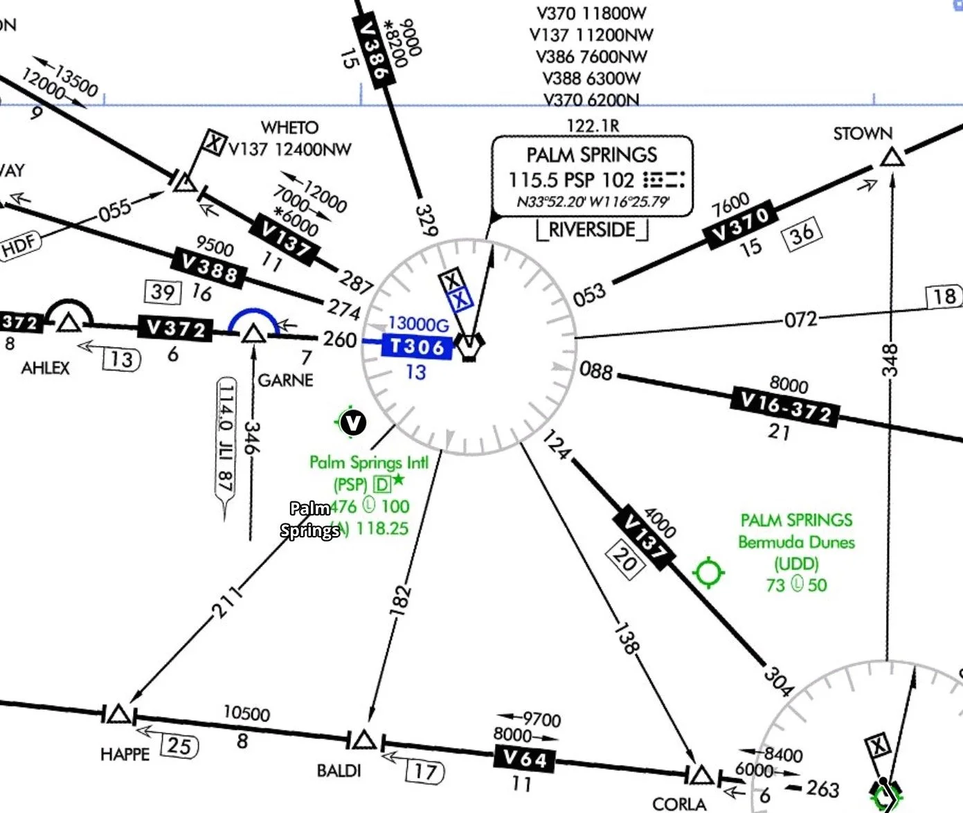
The VOR airway system consists of federal airways designated from 1200 feet above the surface (or in some instances higher) up to but not including 18,000 feet MSL. These airways are magnetic courses and are depicted on En Route Low Altitude Charts. Each airway includes the airspace within parallel boundary lines out to 4NM on each side of the centerline. Except in Alaska and coastal North Carolina, the VOR airways are predicated solely on VOR or VORTAC navigation aids; they are depicted in blue on VFR Sectional Aeronautical Charts and black on IFR en route Low Altitude Charts, and identified by a "V" (Victor) followed by an airway number (e.g., V12). The Victor airways between VORs are marked at either end with a radial out of a VOR, but they are not always exact reciprocals of each other, especially on east-west tracks. This is because they are great circle routes and cross north-south meridians of longitude at different angles. The routes are also affected by magnetic variation, which changes when moving in an east-west direction. In Alaska, some segments of low altitude airways are based on low/medium frequency (LF/MF) navaids such as NDBs and are charted in brown instead of black. There is one airway off the coast of North Carolina called G13 (Green 13).
"T" and "Q" routes are published RNAV routes that can be flight-planned for use by aircraft with RNAV capability. They are depicted in blue on aeronautical charts and identified by a T or Q, followed by the airway number (e.g., T205, Q13). They provide more direct routing for IFR aircraft and enhanced system safety and efficiency. T-routes, depicted on En Route Low Altitude Charts are available for use by RNAV equipped aircraft from 1200 feet above the surface (or in some instances higher) up to but not including 18,000 feet MSL. Q-routes are depicted on En route High Alltitude Charts and are available for use by RNAV equipped aircraft between 18,000 feet MSL and FL450 inclusive.
A segment of an airway which is common to two or more routes carries the numbers of all the airways which coincide for that segment. A changeover point is a point along the route or airway segment between two adjacent navigational facilities or waypoints where changeover in navigational guidance should occur. Mileage breakdown point: occasionally an "x" will appear at a separated segment of an airway that is not an intersection. The "x" is a mileage breakdown or computer navigation fix and indicates a course change.
Airway intersections are designated with five letters, VORs have 3-letter designations, and airports have 4-letter designations beginning with a K.

